
Grimes
‘The most eligible place for a settlement I have seen is on the freshwater river’.
Do these words sound strangely familiar? Perhaps a more familiar phrase would be – “This is the place for a village”. That famous statement spoken by John Batman in 1835 is credited with identifying the original site for the City of Melbourne.
However, the “eligible place for a settlement” described in the first phrase, written thirty-two years earlier in Feb 1803, refers to the same site that has become The City of Melbourne as we know it.
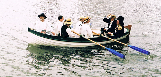
In January 1803, the acting chief surveyor of New South Wales, Charles Grimes, led an expedition to survey Port Phillip Bay. They had been mapping the coast of the Bay from the east when they came across a great river.
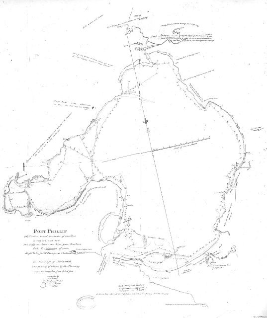
They went up the river and landed two or three miles upstream. They came to a junction of two rivers and took the left stream, the Maribyrnong or ‘The Saltwater River’. From the reports in Fleming’s journal they appeared to have landed near where the Grimes Reserve in Footscray is now.
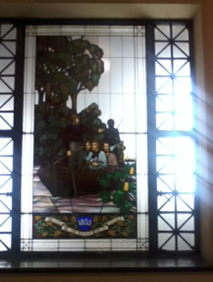
Excerpts from a Journal they kept describe the experience in the Footscray area in 1803……
‘Soon afterwards came to a large river; went up it about a mile when we turned back and waited for the boat to take us on board. The ground is a swamp on one side and high on the other. Saw many swans, pelicans,and ducks. Were obliged to go up to our middle to get to the boat, and got on board between five and six o’clock. Rain and thunder in the night.‘
The myths and controversies continue. However, the important point for our survey is that there is evidence to suggest Grimes’ party set foot on these river banks.
Later they went up the other river, which they named ‘The Freshwater River’, and made the observation of the place for an eligible settlement.
The entire journal of their observations of Port Phillip can be read at….
https://livingmuseum.org.au/charles-grimes-board-11/
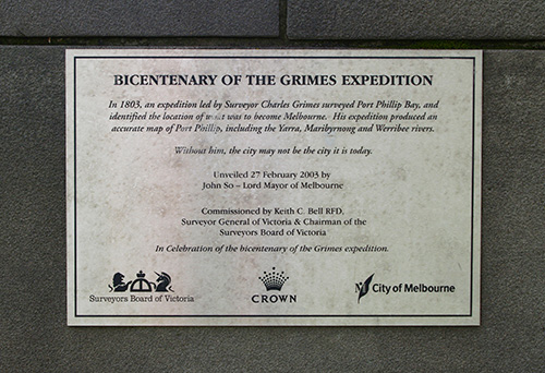
In 2003 The Living Museum in partnership with several local historical societies commemorated the Grimes Survey exhibition.
See https://livingmuseum.org.au/charles-grimes-board-1/


The text on one facet of the monument reads:
‘THIS MONUMENT HAS BEEN ERECTED TO MARK
THE ORIGINAL JUNCTION OF THE
YARRA AND THE MARIBYRNONG RIVERS
WHICH WAS NEAR THIS SPOT.
THESE RIVERS WERE ORIGINALLY
DISCOVERED BY CHARLES EDWARD GRIMES
IN FEBRUARY 1803 AND REFOUND
BY JOHN BATMAN IN JUNE 1835.’
The text on another facet of the monument reads:
PORT PHILLIP WAS DISCOVERED BY JOHN MURRAY
IN THE LADY NELSON IN FEBRUARY 1802.
THE FIRST VESSEL IN HOBSON’S BAY WAS
THE CUMBERLAND WITH GRIMES THE SURVEYOR.
THE FIRST MAN O’WAR WAS THE CALCUTTA.
AT THE END OF THE SAME YEAR 1803.
THE FIRST VESSEL TO ASCEND THE YARRA
WAS JOHN F. FAWKNER’S ENTERPRISE.

the logical place for a settlement
