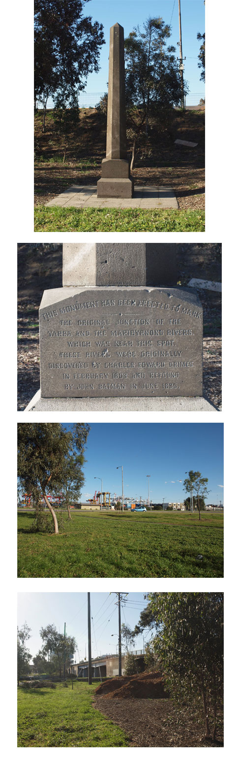
Board 15: The Obelisk
At the time of the Grimes survey in 1803 the structure of Melbourne’s Rivers, The Yarra and the Maribyrnong were different than they are now. The original flow of the Yarra River entered the Maribyrnong River opposite Parker Street, Footscray. Melways Map 42 E6.
This former junction of the two rivers is marked by an obelisk which is almost invisible and very hard to get to. This obelisk is on a small patch of ground just south of Footscray Road on the Melbourne side of the River.
“Thursday, February 3rd. 1803—At six o’clock the captain, Mr. Grimes, self, and five seamen went in the boat up the Great River; at between two and three miles it divided into two; *(27) we took the left hand stream at half-past eight o’clock.” ( A Journal of the Exploration of Charles Grime, 1802-1803 – by James Flemming )
Flemming’s Journal