Introduction: History of a River Bank
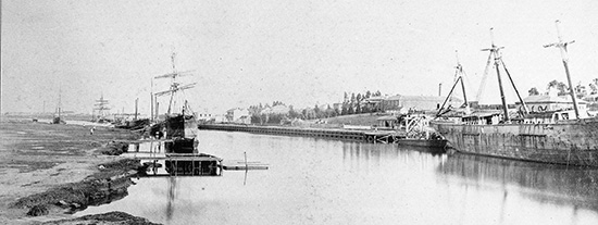
This project is based on a document produced in 1986 by Melbourne’s Living Museum for The Ministry for Planning and Environment. ‘The Survey’, as it was called, was a short and brief history of sites and events on the banks of the Maribyrnong River between Hopkins Street and Napier Street, Footscray. Alternatively it could be described as the area between the Hopetoun Bridge and Shepherd’s Bridge.
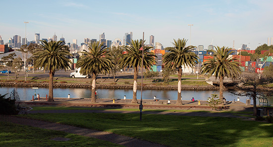
This particular section of the River was near the original junction of the Maribyrnong and the Yarra rivers, opposite Parker Street. Which is why “Yarraville” is called “Yarraville”. Today (2017) this part of the River is still a salt water estuary that extends to Duke Street, the border of the City of Maribyrnong and the City of Brimbank.
The purpose of The Survey was to feed into the Footscray Wharves and Environs Project, implemented by the Ministry for Planning and Environment in conjunction with the City of Footscray and the Port of Melbourne Authority (1986). The wharves restoration project was funded by the Commonwealth State Bicentennial Commemorative Program.
This survey covers just a few short metres of the banks of the Maribyrnong River but these few short metres contain some elements of the remarkable history of the origins of a remarkable inner west suburb.
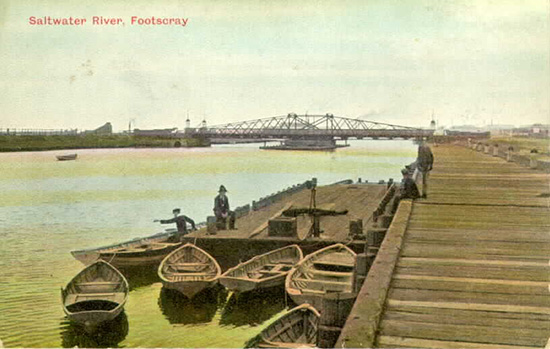
The so called “wild white man”, William Buckley, came this way and is rumoured to have built a chimney somewhere around here. Refugees from the potato famine in Ireland came to live here in the 1840s. Colonial artist, S.T. Gill did a painting on these wharves. The famous WW1 General, Sir John Monash, helped build a bridge across this part of the Maribyrnong River. Years earlier the police magistrate William Lonsdale had run a punt service across the river. And Robert Hoddle planned the first street layout.
So many events in local history, national history and international history have intersected here on this muddy river bank. It is almost incomprehensible how many threads of history have passed through here. This website will hopefully give you a taste of how much has happened here in a very short time. We encourage you to follow the links and do further research to fully appreciate the miracle that is Footscray.